Name of the monument: | Buzeyir cave |
Address of the monument: | AZ4300, Lerik region, Buzeyir village |
Significance of the monument: | An archeological monument of national importance |
Inventory: | 1500 (registered by the Decision of the Cabinet of Ministers of the Republic of Azerbaijan No. 132 dated 02.08.2001) |
Cartographic presentation: | X-coordinate: 41.25524 Y-coordinate: 48.45593 |
Date of construction of the monument: | Century: Stone Age |
Use of the monument: | Used as a venue of demonstration |
Historical information about the monument: One of the signs of the ancient stone memory of the southern region of Azerbaijan is the cave of the same name in the village of Buzeyir, Lerik region, which is considered an archeological monument of national importance.
The Paleolithic archeological expedition of the Institute of Archeology and Ethnography of ANAS conducted archeological excavations in a large area in Buzeyir cave in July-August 1990. As a result, six layers of different periods were recorded in the sediments of the camp. Archaeological excavations in the first and second layers have revealed the remains of clay crockery belonging to the Middle Ages, Bronze and Eneolithic periods. Bone remains and stone products from layer III, stone products and hunted animal bones from layers IV, V and VI were found and examined. Archaeological excavations revealed a total of 61 stone products in the cave. Among the finds were disc-shaped nuclei, levallua sharp tools, flat simple shrapnels, convex simple shrapnels, broken shrapnels and plaques.
The tools found in the Buzeyir cave give an idea of the employment of primitive people living in the Lerik region. Among the findings of the cave was found a second processing of the product. Material samples found in the Buzeyir cave date back to the Mustye period of the Paleolithic.
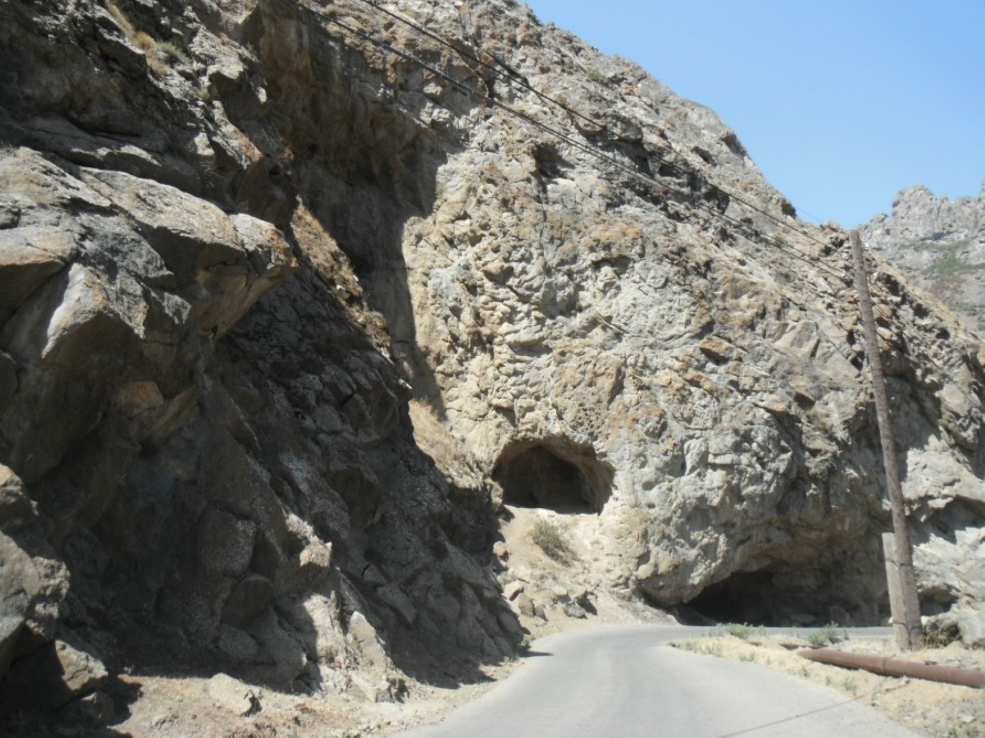
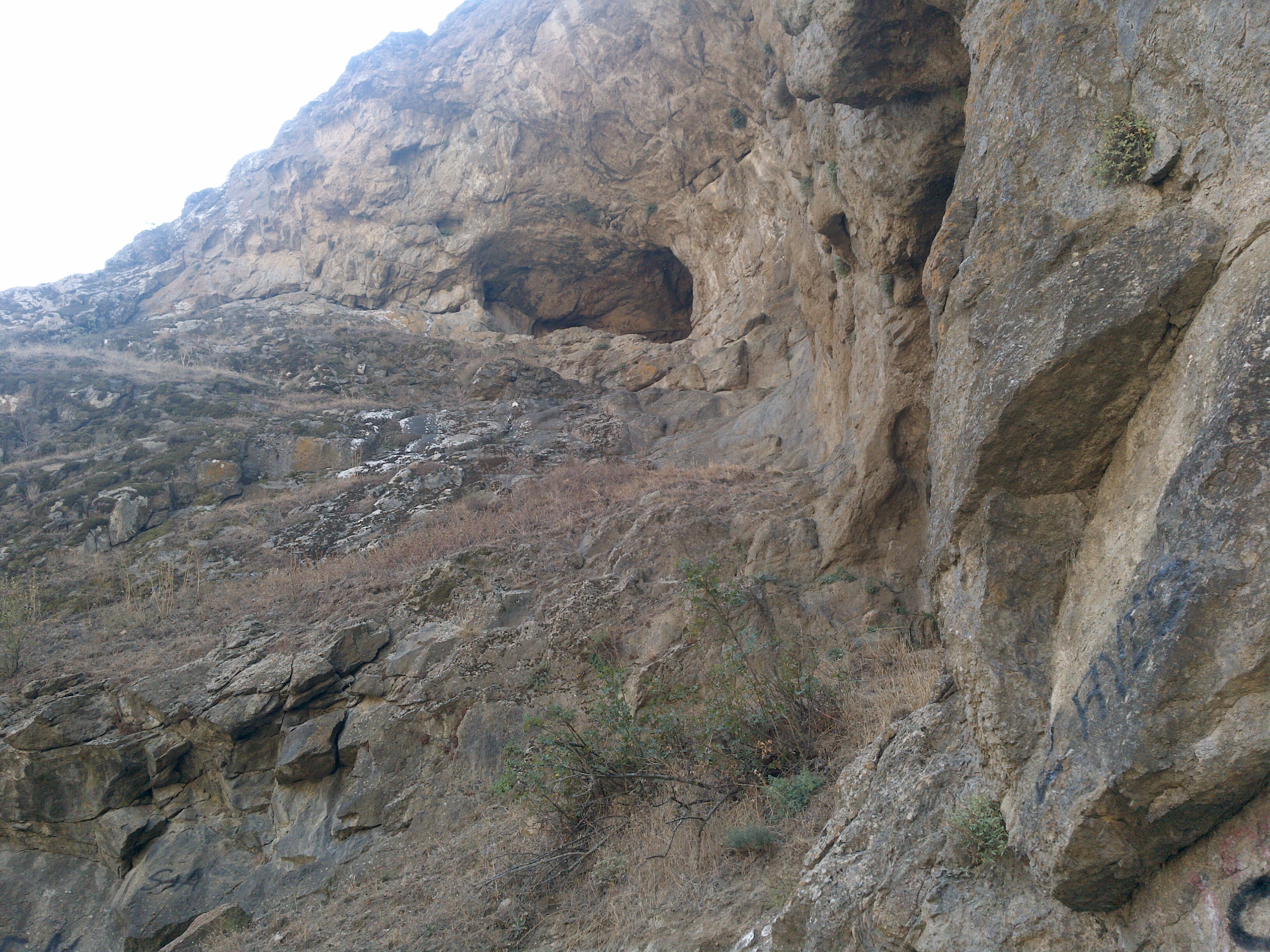
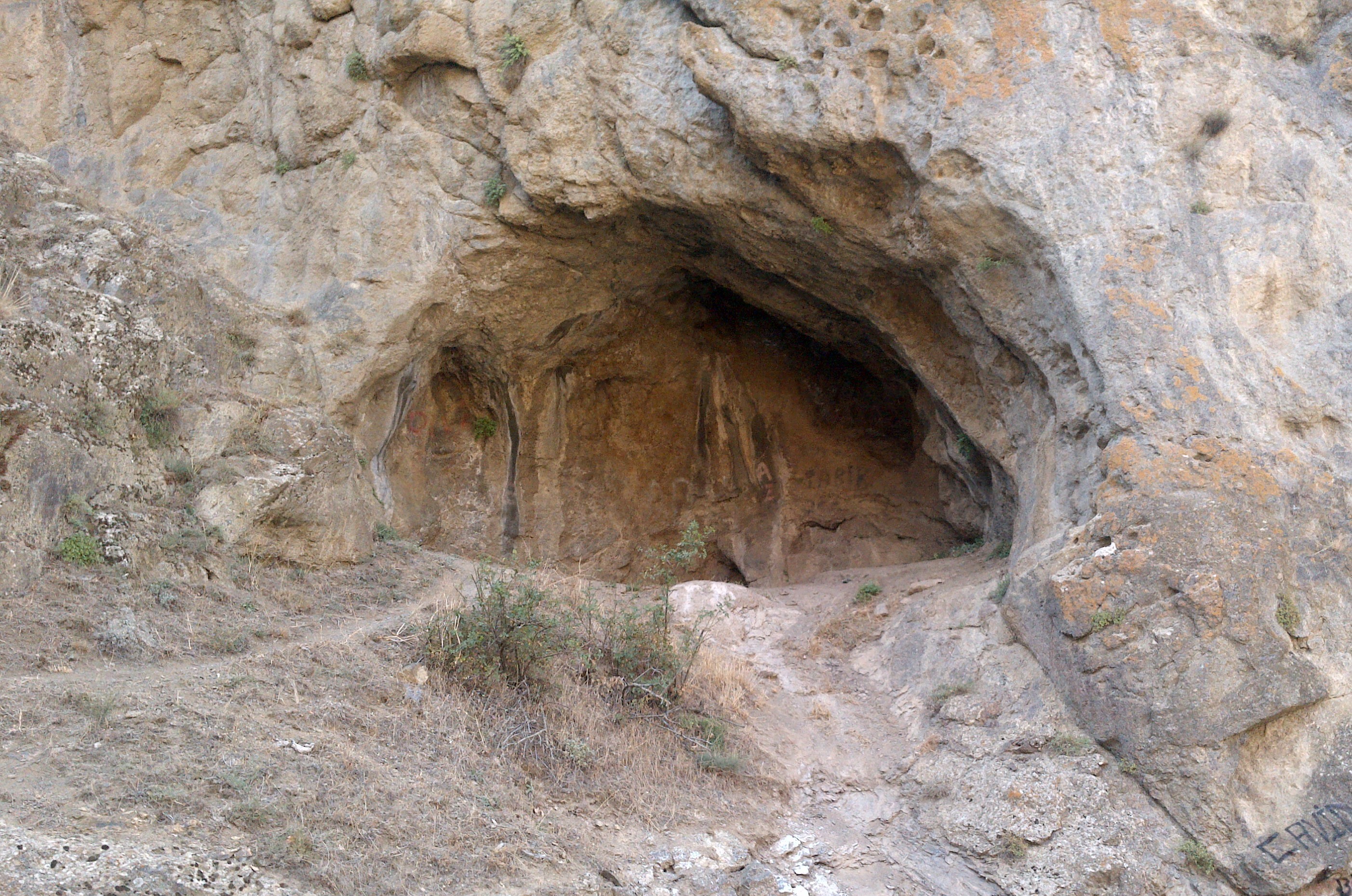
Buzeyir Cave, one of the first human camps in the country, is located on the 10th kilometer of the Lerik-Buzeyir road, on the left bank of the Zuvand River. The cave is located on the Dalikdash peak of the Talish Mountains, at an altitude of 1640 meters above sea level. The length of the cave is 17 meters, the width is 9-14 meters, the height of the cave hole is 10 meters, and the thickness of the sediment is 2-2.5 meters.